

- Lizenzbestimmungen
- Alle Rechte vorbehalten. | All rights reserved. | Tous droits réservés.
- Empfohlene OMSI-Version
- Aktuell v2.3.x
- Vorausgesetzte kommerzielle Erweiterungen
- Keine
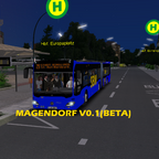
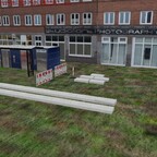
Magendorf is a German map inspired by cities i visited in the country.
It features two lines one of which a Ringline (Line where it finishes where it started).
Reminder that in the future more lines and detail will come.
ENJOY![]()
----------------------------------------------------------------------------------------------------------------------------
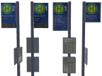
Line 29: StadtRinglinie, St. Antony-Hbf.-Europaplatz-Nordpark-Parplatz ost. 9 mins.
Line 34: Hauptbahnhof-Sormonten 16 mins.
Ziel:
0: Bitte nicht Einsteigen
101: Stadt Ringlinie
102: Sormonten
103: Hauptbahnhof
![]()
![]()
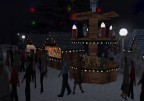
Huge thanks to Nile for the Thema park objects
DOWNLOAD THIS!!!!!!


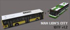
ALTERNATIVE BUS FOR AI LIST:
DROGE
I tried your map. It's reasonably functional but the main weakness at this point, is the widespread use of default M&R Spandau objects. In fact the map is just about limited to these. This without doubt means that driving the map feels like "Spandau V354" (this is a reference to just how many dozens - if not hundreds - of similar maps that have been released since 2011, when OMSI 1 was published). In fact I made a map myself in 2011 called "Tatra Regional" - supposedly set on the Polish / Slovakian border, using nothing but Spandau objects. Of course it looked nothing like the Tatry region!
But 14 years have passed since those maps and the standard has increased x10. There are some stunning freeware maps available now. Sadly, there is nothing to distinguish your map from any of those old maps. Added to this is the very short leg times, which further reduces interest. A 9 minute bus line doesn't hold interest for long.
There are thousands of amazing freeware objects out there now (many available on this site), so there isn't even a reason to make "Spandau" maps any more. When I created 'Tatra Regional' there were no third party freeware objects in existence.
I am not intending to crush your enthusiasm - you can clearly make maps in OMSI, which is no easy task. My advice would be to aim higher..... Collect some 3rd party objects (or use some from other map, as a requirement of your map), install them into OMSI, then go back into your map in the Editor and replace the Spandau objects. I guarantee that your map will be transformed!
Good luck
sk8erwasp Autor
Thx for the opinion again! I will try and implement more 3rd party objects than Spandau Buildings. I'm trying to make the map better in the V1 where longer lines will be added. I will be using 3rd party objects to make the map somewhat modern or closer to current days. As a matter of fact i used the Spandau Buildings for the City centre but i will make the suburbs more modern.
Thx for the opinion!